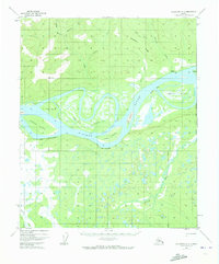
1952 Map of Melozitna A-1
USGS Topo · Published 1973About this map
The Yukon River dominates this mid-century survey, revealing a complex network of shifting channels, sloughs, and islands within the Melozitna region. The landscape is characterized by prominent landmarks like The Palisades and Brant Bluff, which flank the river's path through the interior. A small settlement at Kallands and scattered cabin locations indicate the sparse human footprint in this wilderness during the early 1950s.
Find a feature on this map
33 named features on this map. Tap any name to fly to it.
Don’t see what you’re looking for? This feature index may not catch every label — zoom into the map to look around manually.
Map Details
Editions of this 1952 Melozitna A-1 Map
2 editions found

Other maps of this area

1948 · Kantishna River
USGS Topo · 1:250,000

1951 · Kantishna River
USGS Topo · 1:250,000

1951 · Ruby
USGS Topo · 1:250,000

1951 · Melozitna
USGS Topo · 1:250,000

1951 · Tanana
USGS Topo · 1:250,000

1952 · Melozitna A-2
USGS Topo · 1:63,360

1952 · Ruby D-1
USGS Topo · 1:63,360

1952 · Kantishna River
USGS Topo · 1:250,000

1952 · Tanana A-6
USGS Topo · 1:63,360

1952 · Kantishna River D-6
USGS Topo · 1:63,360