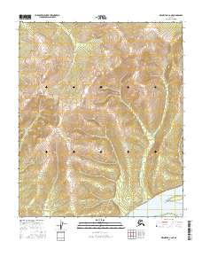
2016 Map of Melozitna A-2 NE
USGS Topo · Published 2016About this map
Birches sits at the southern edge of this interior landscape, positioned along the northern banks of the Yukon River. This 2016 survey captures a transitional zone where the high terrain of Gold Mtn to the northwest gives way to the lower-lying river flats. The mapping reflects the enduring structure of the Public Land Survey System, specifically demarcating the boundaries of t3s r25e, t3s r26e, t4s r25e, and t4s r26e. While the topography is predominantly defined by significant elevation changes near the mountain peaks, the presence of the settlement at Birches indicates a localized focus of activity in a region otherwise characterized by its natural contours and the seasonal rhythms of the great river corridor.
Find a feature on this map
6 named features on this map. Tap any name to fly to it.
Don’t see what you’re looking for? This feature index may not catch every label — zoom into the map to look around manually.
Map Details
Editions of this 2016 Melozitna A-2 NE Map
This is the sole edition of this map. No revisions or reprints were ever made.
Other maps of this area

1951 · Melozitna
USGS Topo · 1:250,000

1952 · Melozitna A-2
USGS Topo · 1:63,360

1952 · Melozitna A-1
USGS Topo · 1:63,360

1953 · Melozitna A-2
USGS Topo · 1:63,360

1956 · Melozitna B-2
USGS Topo · 1:63,360

1956 · Melozitna B-1
USGS Topo · 1:63,360

1956 · Melozitna
USGS Topo · 1:250,000
2016 · Melozitna B-2 SW
USGS Topo · 1:25,000
2016 · Melozitna A-2 SE
USGS Topo · 1:25,000
2016 · Melozitna A-2 SW
USGS Topo · 1:25,000