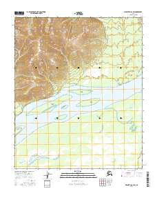
2016 Map of Melozitna A-2 SW
USGS Topo · Published 2016About this map
The braided channels of the Yukon River dominate this 2016 survey, revealing a landscape of shifting silt and timbered isles. Large river features like Lady Island and Burns Island sit within the wide alluvial corridor, while Chokoyik Island and Henry Island further west define the complex waterway. The geography of the riverbanks is marked by distinct landmarks such as Ninemile Point and Lady Point, which serve as critical navigation references in this wilderness region. The surrounding terrain rises sharply from the river valley, with intricate contour lines illustrating the steep ridges of the interior, while the river itself remains the primary corridor for movement through these townships.
Find a feature on this map
12 named features on this map. Tap any name to fly to it.
Don’t see what you’re looking for? This feature index may not catch every label — zoom into the map to look around manually.
Map Details
Editions of this 2016 Melozitna A-2 SW Map
This is the sole edition of this map. No revisions or reprints were ever made.
Other maps of this area

1951 · Ruby
USGS Topo · 1:250,000

1951 · Melozitna
USGS Topo · 1:250,000

1952 · Melozitna A-2
USGS Topo · 1:63,360

1952 · Ruby D-3
USGS Topo · 1:63,360

1952 · Ruby D-2
USGS Topo · 1:63,360

1952 · Ruby
USGS Topo · 1:250,000

1953 · Melozitna A-2
USGS Topo · 1:63,360
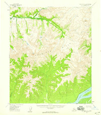
1954 · Melozitna A-3
USGS Topo · 1:63,360

1956 · Melozitna
USGS Topo · 1:250,000

1964 · Ruby
USGS Topo · 1:250,000