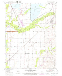
1949 Map of Mendon
USGS Topo · Published 1979About this map
Mendon stands as a primary hub of activity in this northern Missouri landscape, situated near the intersection of the Atchison Topeka And and Wabash rail lines. The terrain is heavily defined by the expansive wetlands and managed waters of the Swan Lake National Wildlife Refuge, where a complex system of levees directs the flow of Yellow Creek and Elk Creek. This interplay between industrial rail transport and intentional water management suggests a mid-century period focused on flood control to protect the surrounding agricultural interests and rail corridors.
Find a feature on this map
21 named features on this map. Tap any name to fly to it.
Don’t see what you’re looking for? This feature index may not catch every label — zoom into the map to look around manually.
Map Details
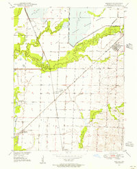
Editions of this 1949 Mendon Map
3 editions found
Other maps of this area

1890 · Marshall
USGS Topo · 1:125,000

1892 · Marshall
USGS Topo · 1:125,000

1901 · Marshall
USGS Topo · 1:125,000

1924 · Hale
USGS Topo · 1:62,500

1949 · Mendon
USGS Topo · 1:24,000

1949 · Indian Grove
USGS Topo · 1:24,000

1949 · Sumner
USGS Topo · 1:24,000

1949 · Rothville
USGS Topo · 1:24,000

1950 · Sumner
USGS Topo · 1:24,000

1950 · Rothville
USGS Topo · 1:24,000