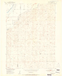
1951 Map of Merino SW
USGS Topo · Published 1952About this map
The South Platte River cuts through the northwest corner of this 1951 topographic survey, defining a landscape shaped by early irrigation efforts in the high plains. The boundary between Morgan Co and Washington Co runs north-south through the terrain, with the Beaver Ditch diverted from the river to support local agriculture. This area, largely comprised of undulating sand hills and basins, shows a clear reliance on groundwater and surface diversions during the mid-century period. Notable landmarks include the Highland School in the southeastern quadrant and Emerson Lake to the west. Numerous Windmills are scattered across the quadrangle, indicating the vital role of individual wells for ranching and homesteading operations far from the primary river valley. The map provides a precise look at the rural infrastructure of the Missouri River Basin development era.
Find a feature on this map
6 named features on this map. Tap any name to fly to it.
Don’t see what you’re looking for? This feature index may not catch every label — zoom into the map to look around manually.
Map Details
Editions of this 1951 Merino SW Map
5 editions found
Other maps of this area

1951 · Messex
USGS Topo · 1:24,000

1951 · Antelope Springs
USGS Topo · 1:24,000

1951 · Merino SW
USGS Topo · 1:24,000

1951 · Brush East
USGS Topo · 1:24,000

1951 · Merino SE
USGS Topo · 1:24,000

1951 · Merino
USGS Topo · 1:24,000

1954 · Sterling
USGS Topo · 1:250,000

1958 · Sterling
USGS Topo · 1:250,000

1965 · Miller Ranch
USGS Topo · 1:24,000

1971 · Brush East
USGS Topo · 1:24,000