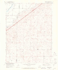
1951 Map of Merino SW
USGS Topo · Published 1972About this map
The South Platte River cuts across the northwest corner of this Colorado landscape, defining the agricultural boundary between Morgan and Washington counties. Mapped in the early 1950s as part of the Missouri River Basin development program, the area showcases the critical role of irrigation in the high plains through features like the Beaver Ditch. This reliance on water management allowed for the establishment of rural community hubs like the Highland School, situated amidst a vast network of windmills that tapped into subterranean resources for livestock and domestic use.
Find a feature on this map
7 named features on this map. Tap any name to fly to it.
Don’t see what you’re looking for? This feature index may not catch every label — zoom into the map to look around manually.
Map Details
Editions of this 1951 Merino SW Map
5 editions found
Other maps of this area

1951 · Messex
USGS Topo · 1:24,000

1951 · Antelope Springs
USGS Topo · 1:24,000

1951 · Merino SW
USGS Topo · 1:24,000

1951 · Brush East
USGS Topo · 1:24,000

1951 · Merino SE
USGS Topo · 1:24,000

1951 · Merino
USGS Topo · 1:24,000

1954 · Sterling
USGS Topo · 1:250,000

1958 · Sterling
USGS Topo · 1:250,000

1965 · Miller Ranch
USGS Topo · 1:24,000

1971 · Brush East
USGS Topo · 1:24,000