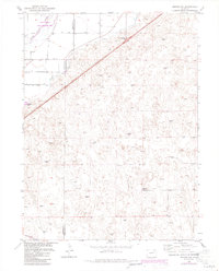
1951 Map of Merino SW
USGS Topo · Published 1984About this map
The South Platte River corridor defines the landscape of the Colorado high plains in this 1951 survey, as it winds through the northwest corner of the quadrangle. This riparian zone, protected in part by a State Wildlife Area, provides a distinct contrast to the surrounding terrain where the topography is marked by the Long Slough and Emerson Lake. The map details the transition from the river valley to the higher ground of Hillrose, illustrating the reliance on water management in this arid region.
Find a feature on this map
10 named features on this map. Tap any name to fly to it.
Don’t see what you’re looking for? This feature index may not catch every label — zoom into the map to look around manually.
Map Details
Editions of this 1951 Merino SW Map
5 editions found
Other maps of this area

1951 · Messex
USGS Topo · 1:24,000

1951 · Antelope Springs
USGS Topo · 1:24,000

1951 · Merino SW
USGS Topo · 1:24,000

1951 · Brush East
USGS Topo · 1:24,000

1951 · Merino SE
USGS Topo · 1:24,000

1951 · Merino
USGS Topo · 1:24,000

1954 · Sterling
USGS Topo · 1:250,000

1958 · Sterling
USGS Topo · 1:250,000

1965 · Miller Ranch
USGS Topo · 1:24,000

1971 · Brush East
USGS Topo · 1:24,000