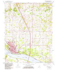
1982 Map of Metropolis
USGS Topo · Published 1983About this map
The riverfront city of Metropolis anchors this 1982 revision, sitting along the northern bank of the Ohio River across from Kentucky. This portion of southern Illinois is characterized by the convergence of major transportation and historical sites, most notably Fort Massac State Park which protects the river shoreline east of the city. The landscape is a mix of urban development and rural tracts, with the Gulf Central Illinois Railroad and Burlington Northern lines servicing the area's commerce.
Find a feature on this map
57 named features on this map. Tap any name to fly to it.
Don’t see what you’re looking for? This feature index may not catch every label — zoom into the map to look around manually.
Map Details
Editions of this 1982 Metropolis Map
2 editions found
Other maps of this area

1917 · Brownfield
USGS Topo · 1:62,500

1918 · Vienna
USGS Topo · 1:62,500

1919 · Vienna
USGS Topo · 1:62,500

1926 · Paducah
USGS Topo · 1:62,500

1928 · La Center
USGS Topo · 1:62,500

1929 · Paducah
USGS Topo · 1:62,500

1932 · La Center
USGS Topo · 1:62,500

1936 · Paducah
USGS Topo · 1:24,000

1940 · Paducah
USGS Topo · 1:62,500

1942 · Vienna
USGS Topo · 1:62,500