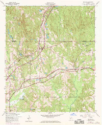
1955 Map of Midland
USGS Topo · Published 1970About this map
Midland stands as a rail-centered community at the intersection of the Southern and Central Of Georgia rail lines, serving as a hub for the surrounding agricultural and timbered lands of Muscogee County. The landscape is dotted with small family and community burial grounds, including the Jenkin Cem, Russ Cem, and McFarlan Cem, which provide significant points of interest for genealogical research. To the south, the Military Reservation Boundary defines the northern edge of the Fort Benning Military Reservation, where the terrain transitions toward Bull Creek and Randall Creek.
Find a feature on this map
32 named features on this map. Tap any name to fly to it.
Don’t see what you’re looking for? This feature index may not catch every label — zoom into the map to look around manually.
Map Details
Editions of this 1955 Midland Map
4 editions found
Other maps of this area

1907 · Talbotton
USGS Topo · 1:125,000

1908 · Columbus
USGS Topo · 1:62,500

1929 · Columbus
USGS Topo · 1:48,000

1947 · Columbus
USGS Topo · 1:62,500

1949 · Midland
USGS Topo · 1:24,000

1949 · Upatoi
USGS Topo · 1:24,000

1949 · Ochillee
USGS Topo · 1:24,000

1949 · Buena Vista NW
USGS Topo · 1:24,000

1949 · Columbus
USGS Topo · 1:24,000

1950 · Fortson
USGS Topo · 1:24,000