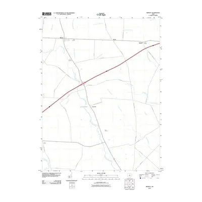
2010 Map of Midway
USGS Topo · Published 2010About this map
Agricultural lands and drainage networks define the landscape of Madison County in this 2010 survey. Small settlements like Midway and Range are situated along the primary east-west corridor, which also links the community of Bethel. The region is heavily marked by its water management history, with numerous man-made channels such as Vallery Ditch, William Cathcart Ditch, and Brock Ditch supplementing the natural flow of North Fork Paint Creek and East Fork Paint Creek.
Find a feature on this map
43 named features on this map. Tap any name to fly to it.
Don’t see what you’re looking for? This feature index may not catch every label — zoom into the map to look around manually.
Map Details
Editions of this 2010 Midway Map
This is the sole edition of this map. No revisions or reprints were ever made.
Other maps of this area

1906 · Mt Sterling
USGS Topo · 1:62,500

1907 · London
USGS Topo · 1:62,500

1907 · South Charleston
USGS Topo · 1:62,500

1916 · Octa
USGS Topo · 1:62,500

1944 · Octa
USGS Topo · 1:62,500

1947 · Columbus
USGS Topo · 1:250,000

1961 · Columbus
USGS Topo · 1:250,000
1961 · Florence
USGS Topo · 1:24,000
1961 · Big Plain
USGS Topo · 1:24,000
1961 · Walnut Run
USGS Topo · 1:24,000