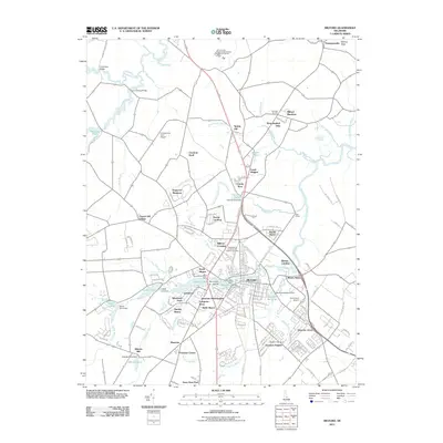
2011 Map of Milford
USGS Topo · Published 2011About this map
The Mispillion River serves as the central artery for this region, flowing through the heart of Milford and toward the Delaware Bay. The landscape is a network of managed water bodies, including Tubmill Pond, Griffith Lake, and Abbotts Pond, many established by historical damming for industrial and agricultural use. While the city of Milford shows significant residential expansion into neighborhoods like Lynch Heights and Woods Haven, the surrounding terrain maintains its coastal plain character with numerous branches such as Tubmill Branch and Deep Branch feeding into the main river systems.
Find a feature on this map
149 named features on this map. Tap any name to fly to it.
Don’t see what you’re looking for? This feature index may not catch every label — zoom into the map to look around manually.
Map Details
Editions of this 2011 Milford Map
This is the sole edition of this map. No revisions or reprints were ever made.
Other maps of this area

1899 · Vineland
USGS Topo · 1:125,000

1899 · Dover
USGS Topo · 1:125,000

1906 · Dover
USGS Topo · 1:125,000

1918 · Cedar Creek
USGS Topo · 1:62,500

1918 · Harrington
USGS Topo · 1:62,500

1919 · Cedar Creek
USGS Topo · 1:62,500

1919 · Vineland
USGS Topo · 1:125,000

1920 · Dover
USGS Topo · 1:125,000

1926 · Wyoming
USGS Topo · 1:48,000

1930 · Wyoming
USGS Topo · 1:62,500