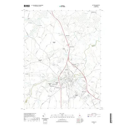
2019 Map of Milford
USGS Topo · Published 2019About this map
Milford serves as the central hub of this coastal plain landscape, straddling the boundary between Kent Co and Sussex Co. The city is defined by its relationship with the Mispillion River, which feeds into Silver Lake and Haven Lake at the heart of the settlement. These water bodies, along with Marshall Millpond to the east, speak to the historic water-powered industry that once anchored the local economy. Beyond the urban center, the map reveals a post-war pattern of residential expansion, with numerous named developments like Wisseman Acres, Lakewood The Heath, and Evergreen Acres filling the spaces between established rural routes.
Find a feature on this map
183 named features on this map. Tap any name to fly to it.
Don’t see what you’re looking for? This feature index may not catch every label — zoom into the map to look around manually.
Map Details
Editions of this 2019 Milford Map
This is the sole edition of this map. No revisions or reprints were ever made.
Other maps of this area

1899 · Vineland
USGS Topo · 1:125,000

1899 · Dover
USGS Topo · 1:125,000

1906 · Dover
USGS Topo · 1:125,000

1918 · Cedar Creek
USGS Topo · 1:62,500

1918 · Harrington
USGS Topo · 1:62,500

1919 · Cedar Creek
USGS Topo · 1:62,500

1919 · Vineland
USGS Topo · 1:125,000

1920 · Dover
USGS Topo · 1:125,000

1926 · Wyoming
USGS Topo · 1:48,000

1930 · Wyoming
USGS Topo · 1:62,500