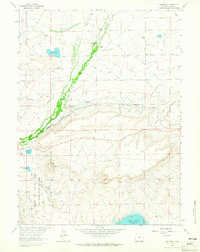
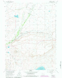
1962 Map of Millbrook
USGS Topo · Published 1965About this map
The Union Pacific railroad and the Little Laramie River shape this stretch of the Wyoming plains during the early 1960s. The landscape is defined by a sophisticated network of irrigation systems, including the Mammoth Ditch, Stewart Canal, and Black Water Ditch, which support an economy of established family homesteads like Whitney Ranch, Lohan Ranch, and McCue Ranch. The small settlement of Hatton and the Millbrook Sch serve as local hubs along the rail line, reflecting the rural community structure of Albany County before modern consolidation.
Find a feature on this map
47 named features on this map. Tap any name to fly to it.
Don’t see what you’re looking for? This feature index may not catch every label — zoom into the map to look around manually.
Map Details
Editions of this 1962 Millbrook Map
5 editions found
Other maps of this area

1895 · Laramie
USGS Topo · 1:125,000

1902 · Laramie
USGS Topo · 1:125,000

1905 · Laramie
USGS Topo · 1:125,000

1906 · Medicine Bow
USGS Topo · 1:125,000

1906 · Laramie
USGS Topo · 1:125,000

1908 · Laramie
USGS Topo · 1:125,000

1908 · Medicine Bow
USGS Topo · 1:125,000

1954 · Cheyenne
USGS Topo · 1:250,000

1954 · Rawlins
USGS Topo · 1:250,000

1958 · Rawlins
USGS Topo · 1:250,000