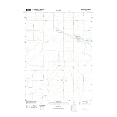
2012 Map of Milledgeville
USGS Topo · Published 2012About this map
Milledgeville serves as the primary hub in this rural landscape within Carroll County, where the grid of early twentieth-century roads meets the meandering course of Elkhorn Cr. The map reveals a high concentration of burial grounds that anchor the local heritage, including the Dutchtown Brethern Cem and Hazel Green Cem, alongside the small southern settlement of Coleta. This area is defined by its drainage network, with Otter Cr and Rock Cr carving through the agricultural sections. The road names, such as Dutchtown Rd and Wysox Rd, reflect the historic corridors connecting these small prairie communities. For genealogists, the map provides a precise spatial record of family-named landmarks and secluded cemeteries like Colcord Cem and Bethel Cem situated among the farmstead layouts.
Find a feature on this map
60 named features on this map. Tap any name to fly to it.
Don’t see what you’re looking for? This feature index may not catch every label — zoom into the map to look around manually.
Map Details
Editions of this 2012 Milledgeville Map
This is the sole edition of this map. No revisions or reprints were ever made.
Other maps of this area

1930 · Woodsung
USGS Topo · 1:48,000

1934 · Morrison
USGS Topo · 1:48,000

1940 · Morrison
USGS Topo · 1:62,500

1942 · Mt Carroll
USGS Topo · 1:62,500

1942 · Forreston
USGS Topo · 1:62,500

1944 · Mt Carroll
USGS Topo · 1:62,500

1945 · Forreston
USGS Topo · 1:62,500

1946 · Sterling
USGS Topo · 1:62,500

1948 · Sterling
USGS Topo · 1:62,500

1954 · Rockford
USGS Topo · 1:250,000