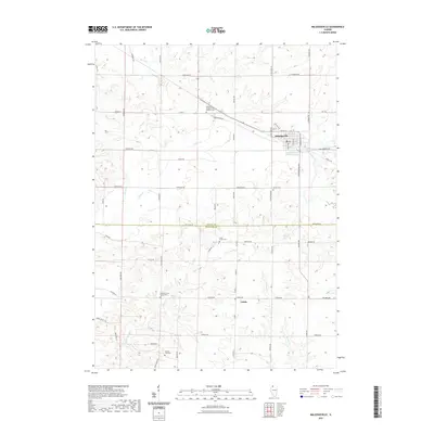
2021 Map of Milledgeville
USGS Topo · Published 2021About this map
Milledgeville serves as the primary hub in this agricultural landscape where the borders of Carroll and Whiteside counties meet. The terrain is defined by a dense network of waterways, including Rock Cr, Otter Cr, and Elkhorn Creek, which carve through the tillable acreage of Northern Illinois. For those tracing local history or family lineage, the map identifies several rural landmarks such as the Dutchtown Church of the Brethren Cem and the Geneseo Grove Center Cem. Further south, the settlement of Coleta marks a focal point for the surrounding farmsteads. The road network, including Co Hwy 8 and Milledgeville Rd, illustrates the enduring rural grid system, connecting isolated cemeteries like Colcord Cemetary and Bethel Cem to the region's larger population centers.
Find a feature on this map
59 named features on this map. Tap any name to fly to it.
Don’t see what you’re looking for? This feature index may not catch every label — zoom into the map to look around manually.
Map Details
Editions of this 2021 Milledgeville Map
This is the sole edition of this map. No revisions or reprints were ever made.
Other maps of this area

1930 · Woodsung
USGS Topo · 1:48,000

1934 · Morrison
USGS Topo · 1:48,000

1940 · Morrison
USGS Topo · 1:62,500

1942 · Mt Carroll
USGS Topo · 1:62,500

1942 · Forreston
USGS Topo · 1:62,500

1944 · Mt Carroll
USGS Topo · 1:62,500

1945 · Forreston
USGS Topo · 1:62,500

1946 · Sterling
USGS Topo · 1:62,500

1948 · Sterling
USGS Topo · 1:62,500

1954 · Rockford
USGS Topo · 1:250,000