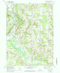
1967 Map of Millers Station
USGS Topo · Published 1984About this map
French Creek winds through the western landscape of this mid-1960s survey, defining a valley shared by the Erie-Lackawanna railroad and the settlement of Millers Station. The region is characterized by numerous family-named crossroads and small agricultural hubs, such as Hinkley Corners, Jervis Corners, and Sturgis Corners. These small nodes of activity suggest a long-established rural network where local identity was tied closely to specific intersections and family landholdings.
Find a feature on this map
52 named features on this map. Tap any name to fly to it.
Don’t see what you’re looking for? This feature index may not catch every label — zoom into the map to look around manually.
Map Details
Editions of this 1967 Millers Station Map
3 editions found
Other maps of this area

1923 · Meadville
USGS Topo · 1:62,500

1923 · Cambridge Springs
USGS Topo · 1:62,500

1925 · Meadville
USGS Topo · 1:62,500

1925 · Cambridge Springs
USGS Topo · 1:62,500

1927 · Townville
USGS Topo · 1:48,000

1929 · Union City
USGS Topo · 1:62,500

1932 · Townville
USGS Topo · 1:62,500

1932 · Union City
USGS Topo · 1:62,500

1943 · Meadville
USGS Topo · 1:62,500

1943 · Cambridge Springs
USGS Topo · 1:62,500