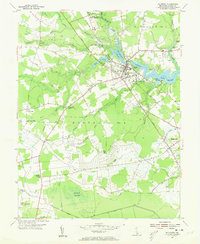
1954 Map of Millsboro
USGS Topo · Published 1955About this map
The Indian River headwaters and Millsboro Pond define the landscape of this mid-century Sussex County survey, where the town of Millsboro serves as a hub for both the Pennsylvania railroad and the Dupont Highway. The map reveals a complex network of man-made and natural drainage, from the Houston-Thorogood Ditch to the Sheeppen Ditch, illustrating the intensive management of the surrounding wetlands and farms.
Find a feature on this map
53 named features on this map. Tap any name to fly to it.
Don’t see what you’re looking for? This feature index may not catch every label — zoom into the map to look around manually.
Map Details
Editions of this 1954 Millsboro Map
3 editions found
Other maps of this area

1901 · Ocean City
USGS Topo · 1:62,500

1902 · Pittsville
USGS Topo · 1:62,500

1917 · Millsboro
USGS Topo · 1:62,500

1918 · Rehoboth
USGS Topo · 1:62,500

1938 · Millsboro
USGS Topo · 1:62,500

1938 · Rehoboth
USGS Topo · 1:62,500

1942 · Ocean City
USGS Topo · 1:62,500

1942 · Whaleysville
USGS Topo · 1:24,000

1942 · Pittsville
USGS Topo · 1:24,000

1943 · Selbyville
USGS Topo · 1:31,680