
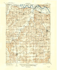
1910 Map of Milo
USGS Topo · Published 1910About this map
Milo and the surrounding townships of Richland and Belmont appear as a dense network of agrarian settlements and school districts in this 1910 study. The Chicago Burlington and Quincy RR provides the primary industrial artery, with its Indianola Branch connecting smaller hubs like Ackworth and the rural rail junction at Milo. Along the northern border, the Des Moines River winds past Morgan Valley and the settlement of Swan, while the interior landscape is defined by its numerous neighborhood schools, such as Goose Hill School and Linn Grove School. The presence of landmarks like Hammondsburg Bridge and Pennington Bridge over the South River highlights the critical local crossings of the era. Smaller communities like Sandyville and Caloma serve as anchors for the farming population, situated away from the primary rail lines and connected by established wagon roads.
Find a feature on this map
86 named features on this map. Tap any name to fly to it.
Don’t see what you’re looking for? This feature index may not catch every label — zoom into the map to look around manually.
Map Details
Editions of this 1910 Milo Map
2 editions found
Other maps of this area

1905 · Des Moines
USGS Topo · 1:62,500

1907 · Des Moines
USGS Topo · 1:62,500

1909 · Knoxville
USGS Topo · 1:62,500

1912 · Knoxville
USGS Topo · 1:62,500

1918 · Chariton
USGS Topo · 1:62,500

1924 · Melcher
USGS Topo · 1:62,500

1930 · Mitchellville
USGS Topo · 1:62,500

1931 · Indianola
USGS Topo · 1:62,500

1950 · New Virginia
USGS Topo · 1:62,500

1952 · New Virginia
USGS Topo · 1:62,500