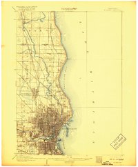
1906 Map of Milwaukee
USGS Topo · Published 1918About this map
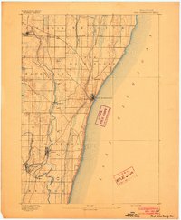
Milwaukee River carving a path southward toward the city center defines the industrial and residential development of this Lake Michigan shoreline at the turn of the century. The map captures Milwaukee as a dense urban grid expanding rapidly into neighboring areas like Wauwatosa and West Allis. Along the coast, the topography reveals the distinctive curve of Whitefish Bay and the prominent landmark of North Point, while the interior is crisscrossed by an extensive rail network including the Chicago Milwaukee and St Paul RR and the Lake Shore Line.
Find a feature on this map
30 named features on this map. Tap any name to fly to it.
Don’t see what you’re looking for? This feature index may not catch every label — zoom into the map to look around manually.
Map Details
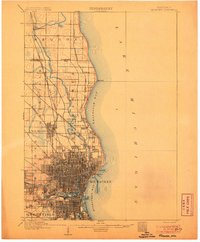
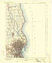
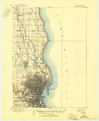
Editions of this 1906 Milwaukee Map
4 editions found
Other maps of this area

1891 · Bayview
USGS Topo · 1:62,500

1891 · Muskego
USGS Topo · 1:62,500

1892 · Milwaukee
USGS Topo · 1:62,500

1892 · Waukesha
USGS Topo · 1:62,500
1892 · Port Washington
USGS Topo · 1:62,500

1901 · Milwaukee
USGS Topo · 1:62,500

1901 · Waukesha
USGS Topo · 1:62,500

1901 · Bayview
USGS Topo · 1:62,500

1901 · Muskego
USGS Topo · 1:62,500

1904 · West Bend
USGS Topo · 1:62,500