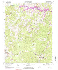
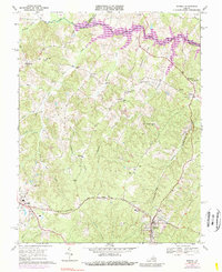
1969 Map of Mineral
USGS Topo · Published 1983About this map
Mineral and Louisa anchor this map of central Virginia, appearing during a period of significant landscape transformation as Lake Anna begins to take shape along the North Anna River. The map captures the transition from an agricultural and mineral-extraction economy toward modern development, while preserving the footprints of older industries. A Gold Mine near Gold Mine Creek and multiple other mines point to the area's namesake geological history, while the Chesapeake and Ohio railroad serves the established town centers. Rural life is evidenced by scattered country stores like Dickinson Store and Bibbs Store, and a dense network of local houses of worship including Enon Ch and St Johns Ch. The presence of a Drive-in Theater and County High Sch reflects the mid-century community character, even as an Old Railroad Grade and numerous unnamed family cemeteries suggest the deep-rooted genealogical layers of the county.
Find a feature on this map
42 named features on this map. Tap any name to fly to it.
Don’t see what you’re looking for? This feature index may not catch every label — zoom into the map to look around manually.
Map Details
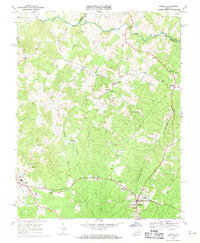
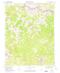
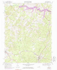
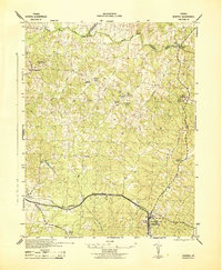
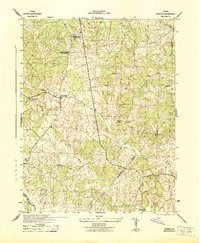
Editions of this 1969 Mineral Map
5 editions found
Other maps of this area

1887 · Spottsylvania
USGS Topo · 1:125,000

1890 · Goochland
USGS Topo · 1:125,000

1891 · Palmyra
USGS Topo · 1:125,000

1892 · Spottsylvania
USGS Topo · 1:125,000

1892 · Goochland
USGS Topo · 1:125,000

1892 · Gordonsville
USGS Topo · 1:125,000

1895 · Palmyra
USGS Topo · 1:125,000

1897 · Palmyra
USGS Topo · 1:125,000
1942 · Mineral
USGS Topo · 1:31,680
1942 · Lahore
USGS Topo · 1:31,680