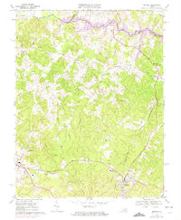
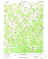
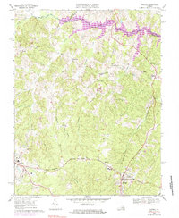
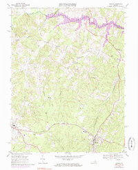
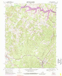
1969 Map of Mineral
USGS Topo · Published 1974About this map
The town of Mineral and the county seat of Louisa anchor this 1969 survey, a landscape defined by the arrival of the Lake Anna reservoir and a long history of resource extraction. The Chesapeake and Ohio railroad cuts across the lower half of the sheet, connecting these hubs through a countryside dotted with numerous rural congregations like Thessalonian Ch and Gold Mine Ch. The map captures the region during a period of significant change, showing the nascent northern reach of the lake alongside older landmarks like the Old Railroad Grade and numerous small-scale mines. This intersection of rail transport, emerging water infrastructure, and established crossroads communities like Bibbs Store and Wares Crossroads reveals the evolving economic and social fabric of central Virginia in the late twentieth century.
Find a feature on this map
43 named features on this map. Tap any name to fly to it.
Don’t see what you’re looking for? This feature index may not catch every label — zoom into the map to look around manually.
Map Details
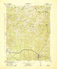
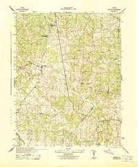
Editions of this 1969 Mineral Map
5 editions found
Other maps of this area

1887 · Spottsylvania
USGS Topo · 1:125,000

1890 · Goochland
USGS Topo · 1:125,000

1891 · Palmyra
USGS Topo · 1:125,000

1892 · Spottsylvania
USGS Topo · 1:125,000

1892 · Goochland
USGS Topo · 1:125,000

1892 · Gordonsville
USGS Topo · 1:125,000

1895 · Palmyra
USGS Topo · 1:125,000

1897 · Palmyra
USGS Topo · 1:125,000
1942 · Mineral
USGS Topo · 1:31,680
1942 · Lahore
USGS Topo · 1:31,680