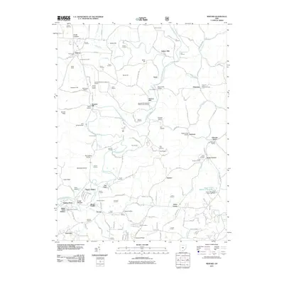
2011 Map of Minford
USGS Topo · Published 2011About this map
Scioto Furnace and Harrison Mills serve as focal points in this section of Scioto County, where the landscape is defined by the winding course of the Little Scioto River. The map reveals a dense network of family and community history, evidenced by over two dozen burial grounds including Saint Johns Cemetery, Pinkerman United Brethren Cemetery, and Rigrish Cemetery. Local industry and agriculture are visible through landmarks like Fuhrmann Orchards and historical milling sites such as Wallace Mills and Wheelers Mill.
Find a feature on this map
139 named features on this map. Tap any name to fly to it.
Don’t see what you’re looking for? This feature index may not catch every label — zoom into the map to look around manually.
Map Details
Editions of this 2011 Minford Map
This is the sole edition of this map. No revisions or reprints were ever made.
Other maps of this area

1898 · Ironton
USGS Topo · 1:62,500

1900 · Ironton
USGS Topo · 1:62,500

1911 · Sciotoville
USGS Topo · 1:62,500

1912 · Oak Hill
USGS Topo · 1:62,500

1913 · Sciotoville
USGS Topo · 1:62,500

1926 · Greenup
USGS Topo · 1:48,000

1930 · Greenup
USGS Topo · 1:62,500
1953 · Portsmouth
USGS Topo · 1:24,000

1957 · Huntington
USGS Topo · 1:250,000

1960 · Huntington
USGS Topo · 1:250,000