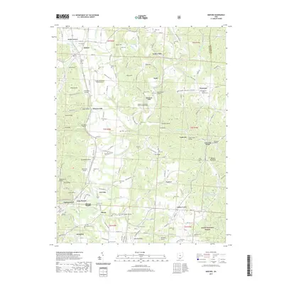
2019 Map of Minford
USGS Topo · Published 2019About this map
The Little Scioto River winds through this landscape of the western Appalachian foothills, defining a region where early industry and modern infrastructure meet. Historically significant sites such as Scioto Furnace and Wheelers Mill speak to the area's 19th-century manufacturing and milling roots, while the Greater Portsmouth Regional Airport marks its contemporary utility. The map is exceptionally dense with family-named cemeteries, providing a detailed record for genealogists studying the settlements of Minford, Pinkerman, and Sciotodale.
Find a feature on this map
112 named features on this map. Tap any name to fly to it.
Don’t see what you’re looking for? This feature index may not catch every label — zoom into the map to look around manually.
Map Details
Editions of this 2019 Minford Map
This is the sole edition of this map. No revisions or reprints were ever made.
Other maps of this area

1898 · Ironton
USGS Topo · 1:62,500

1900 · Ironton
USGS Topo · 1:62,500

1911 · Sciotoville
USGS Topo · 1:62,500

1912 · Oak Hill
USGS Topo · 1:62,500

1913 · Sciotoville
USGS Topo · 1:62,500

1926 · Greenup
USGS Topo · 1:48,000

1930 · Greenup
USGS Topo · 1:62,500
1953 · Portsmouth
USGS Topo · 1:24,000

1957 · Huntington
USGS Topo · 1:250,000

1960 · Huntington
USGS Topo · 1:250,000