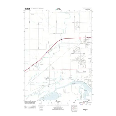
2012 Map of Minooka
USGS Topo · Published 2012About this map
The confluence of the Des Plaines River and the Kankakee River creates a complex riverine landscape at the southern end of this map, forming the Illinois River and defining the local geography. This waterway network is dotted with landmarks like Dresden Island and Little Dresden Island, while the nearby Kankakee Bluffs rise above the riverbanks. The settlement of Minooka serves as a primary hub, with its suburban growth extending toward the Des Plaines River corridor.
Find a feature on this map
108 named features on this map. Tap any name to fly to it.
Don’t see what you’re looking for? This feature index may not catch every label — zoom into the map to look around manually.
Map Details
Editions of this 2012 Minooka Map
This is the sole edition of this map. No revisions or reprints were ever made.
Other maps of this area

1892 · Morris
USGS Topo · 1:62,500

1892 · Joliet
USGS Topo · 1:62,500

1892 · Wilmington
USGS Topo · 1:62,500

1918 · Wilmington
USGS Topo · 1:62,500

1918 · Morris
USGS Topo · 1:62,500

1923 · Joliet
USGS Topo · 1:62,500

1925 · Yorkville
USGS Topo · 1:62,500

1953 · Morris
USGS Topo · 1:24,000

1953 · Plattville
USGS Topo · 1:24,000

1953 · Lisbon
USGS Topo · 1:24,000