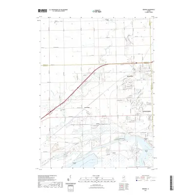
2021 Map of Minooka
USGS Topo · Published 2021About this map
Minooka and Channahon anchor this 2021 study of a landscape defined by the confluence of major Illinois waterways. The map details the complex geography where the Des Plaines River and Kankakee River join to form the Illinois River, a critical junction for regional transport and water management. Modern industrial footprints are evident near Divine and the massive cooling reservoir of Heidecke Lake, contrasting with the numerous historical burial grounds scattered across the terrain, including the Seward Mound Cem and Plattville Lutheran Cem. The BNSF Railway and major thoroughfares like Shady Oaks Rd bisect the area, illustrating the transit corridor's evolution. Natural features like Aux Sable Creek and the Kankakee Bluffs provide topographic relief against the developed residential grids and utility infrastructure that dominate the eastern portion of the quadrangle.
Find a feature on this map
112 named features on this map. Tap any name to fly to it.
Don’t see what you’re looking for? This feature index may not catch every label — zoom into the map to look around manually.
Map Details
Editions of this 2021 Minooka Map
This is the sole edition of this map. No revisions or reprints were ever made.
Other maps of this area

1892 · Morris
USGS Topo · 1:62,500

1892 · Joliet
USGS Topo · 1:62,500

1892 · Wilmington
USGS Topo · 1:62,500

1918 · Wilmington
USGS Topo · 1:62,500

1918 · Morris
USGS Topo · 1:62,500

1923 · Joliet
USGS Topo · 1:62,500

1925 · Yorkville
USGS Topo · 1:62,500

1953 · Morris
USGS Topo · 1:24,000

1953 · Plattville
USGS Topo · 1:24,000

1953 · Lisbon
USGS Topo · 1:24,000