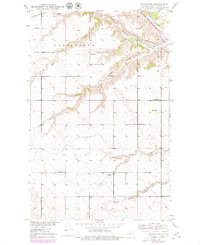
1948 Map of Minot NW
USGS Topo · Published 1980About this map
The Souris River winds through the northeast corner of this terrain, marking a sharp contrast to the high, dry plains that dominate the surrounding landscape. In this 1948 survey, the area is defined by the deep incisions of coulees, including Gassman Coulee and South Branch Coulee, which drain the tablelands into the river valley. The agricultural and rural character of the region is evident in the presence of scattered country schools like School No 2 and School No 1, and the small settlement of Ralston.
Find a feature on this map
15 named features on this map. Tap any name to fly to it.
Don’t see what you’re looking for? This feature index may not catch every label — zoom into the map to look around manually.
Map Details
Editions of this 1948 Minot NW Map
2 editions found
Other maps of this area

1928 · Minot
USGS Topo · 1:62,500

1948 · Burlington
USGS Topo · 1:24,000

1948 · Burlington
USGS Topo · 1:62,500

1948 · Minot NW
USGS Topo · 1:24,000

1949 · Minot NW
USGS Topo · 1:24,000

1949 · Burlington SE
USGS Topo · 1:24,000

1949 · Minot
USGS Topo · 1:24,000

1950 · Des Lacs
USGS Topo · 1:24,000
1950 · Burlington
USGS Topo · 1:24,000
1951 · Burlington
USGS Topo · 1:62,500