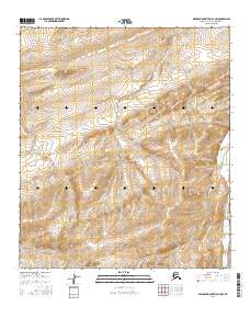
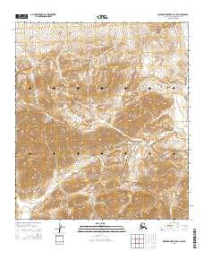
2016 Map of Misheguk Mountain C-4 NW
USGS Topo · Published 2016About this map
Ilingnorak Ridge dominates the northern landscape of this remote Arctic region, where the terrain transitions through a complex series of high-elevation contours. The drainage patterns are defined by the winding course of Adventure Creek, which cuts through the central portion of the quadrangle. In the eastern sector, the Utukok River flows northward, serving as a primary hydrological feature in an area devoid of permanent human settlements or infrastructure. The U.S. Geological Survey mapping reveals a vast, untouched wilderness within the North Slope Borough, where natural topographical boundaries take precedence over man-made landmarks.
Find a feature on this map
8 named features on this map. Tap any name to fly to it.
Don’t see what you’re looking for? This feature index may not catch every label — zoom into the map to look around manually.
Map Details
Editions of this 2016 Misheguk Mountain C-4 NW Map
This is the sole edition of this map. No revisions or reprints were ever made.
Other maps of this area

1951 · Misheguk Mountain
USGS Topo · 1:250,000

1956 · Misheguk Mountain
USGS Topo · 1:250,000
1984 · Misheguk Mountain C-5
USGS Topo · 1:63,360
1984 · Misheguk Mountain D-5
USGS Topo · 1:63,360
1984 · Misheguk Mountain C-4
USGS Topo · 1:63,360
1984 · Misheguk Mountain D-4
USGS Topo · 1:63,360
2014 · Misheguk Mountain C-5 SE
USGS Topo · 1:25,000
2015 · Misheguk Mountain C-5 NE
USGS Topo · 1:25,000
2015 · Misheguk Mountain D-5 SE
USGS Topo · 1:25,000
2015 · Misheguk Mountain C-4 SW
USGS Topo · 1:25,000