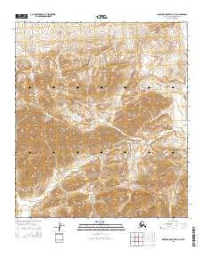
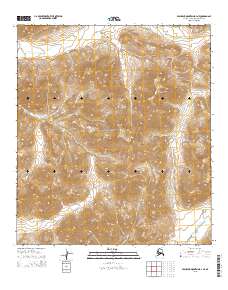
2015 Map of Misheguk Mountain C-4 SW
USGS Topo · Published 2015About this map
The southern portion of this landscape is protected within the Noatak National Preserve, a designation that shapes the character of the central Brooks Range foothills. The terrain is defined by the high prominence of Tupik Mtn, which serves as a significant drainage divide for several watercourses. Several primary waterways originate or pass through this area, including the Utukok River to the east and the headwaters of Iligluruk Cr in the northwest. To the south, Nunavikak Cr and Cairn Cr draw from the high slopes, while Tupik Cr cuts through the central region. This map illustrates the undeveloped Arctic wilderness as it was documented in the early 21st century, showing the intricate contouring of the ridges and the network of drainages that define the North Slope's interior.
Find a feature on this map
16 named features on this map. Tap any name to fly to it.
Don’t see what you’re looking for? This feature index may not catch every label — zoom into the map to look around manually.
Map Details
Editions of this 2015 Misheguk Mountain C-4 SW Map
This is the sole edition of this map. No revisions or reprints were ever made.
Other maps of this area

1951 · Misheguk Mountain
USGS Topo · 1:250,000

1956 · Misheguk Mountain
USGS Topo · 1:250,000
1984 · Misheguk Mountain C-5
USGS Topo · 1:63,360
1984 · Misheguk Mountain C-4
USGS Topo · 1:63,360
1990 · Misheguk Mountain B-5
USGS Topo · 1:63,360
1990 · Misheguk Mountain B-4
USGS Topo · 1:63,360
2014 · Misheguk Mountain C-5 SE
USGS Topo · 1:25,000
2014 · Misheguk Mountain B-5 NE
USGS Topo · 1:25,000
2015 · Misheguk Mountain C-5 NE
USGS Topo · 1:25,000
2015 · Misheguk Mountain B-4 NE
USGS Topo · 1:25,000