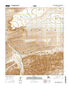
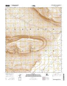
2016 Map of Misheguk Mountain D-3 SW
USGS Topo · Published 2016About this map
Driftwood Creek carves a path through the southern reaches of this landscape in the North Slope Borough, where the terrain transitions into complex high-elevation landforms. Located within the Misheguk Mountain quadrangle, the area is defined by its dramatic relief and the headwaters of remote drainages such as Amo Cr, which flows through the northern sections of the survey. The mapping follows the standard Township and Range grid, covering portions of t7s r37w, t8s r37w, and surrounding boundaries. This region represents a pristine example of the Arctic slope's interior, where drainage patterns are dictated by the underlying structural geology rather than human development. The absence of permanent structures or roads underscores the wilderness character of these highlands near the Brooks Range during the early twenty-first century.
Find a feature on this map
8 named features on this map. Tap any name to fly to it.
Don’t see what you’re looking for? This feature index may not catch every label — zoom into the map to look around manually.
Map Details
Editions of this 2016 Misheguk Mountain D-3 SW Map
This is the sole edition of this map. No revisions or reprints were ever made.
Other maps of this area

1951 · Misheguk Mountain
USGS Topo · 1:250,000

1956 · Misheguk Mountain
USGS Topo · 1:250,000
1984 · Misheguk Mountain C-3
USGS Topo · 1:63,360
1984 · Misheguk Mountain D-3
USGS Topo · 1:63,360
1984 · Misheguk Mountain C-4
USGS Topo · 1:63,360
1984 · Misheguk Mountain D-4
USGS Topo · 1:63,360
2016 · Misheguk Mountain C-3 NW
USGS Topo · 1:25,000
2016 · Misheguk Mountain D-4 NE
USGS Topo · 1:25,000
2016 · Misheguk Mountain D-4 SE
USGS Topo · 1:25,000
2016 · Misheguk Mountain D-3 NW
USGS Topo · 1:25,000