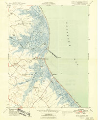
1949 Map of Mispillion River
USGS Topo · Published 1949About this map
The Mispillion River flows through a complex landscape of tidal marshes and low-lying necks as it meets the Delaware Bay. This coastal survey, compiled in part from 1946 aerial photography, documents the intricate drainage network of Grecos Canal, Crooked Gut, and Beaverdam Branch. Human activity is concentrated along the higher ground of Milford Neck and Cedar Neck, where established landmarks like Cedar Neck Ch and Cedar Neck Sch served the local community.
Find a feature on this map
30 named features on this map. Tap any name to fly to it.
Don’t see what you’re looking for? This feature index may not catch every label — zoom into the map to look around manually.
Map Details
Editions of this 1949 Mispillion River Map
2 editions found
Other maps of this area

1890 · Maurice Cove
USGS Topo · 1:62,500

1891 · Maurice Cove
USGS Topo · 1:62,500

1899 · Vineland
USGS Topo · 1:125,000

1918 · Cedar Creek
USGS Topo · 1:62,500

1918 · Cape Henlopen
USGS Topo · 1:62,500

1919 · Cedar Creek
USGS Topo · 1:62,500

1919 · Vineland
USGS Topo · 1:125,000

1934 · Bowers
USGS Topo · 1:48,000
1936 · Bowers
USGS Topo · 1:62,500

1937 · Cape Henlopen
USGS Topo · 1:62,500