Loading...
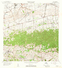
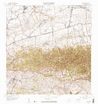
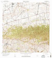
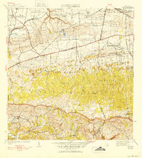
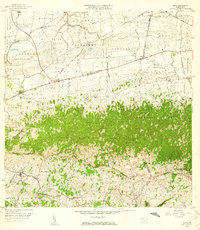
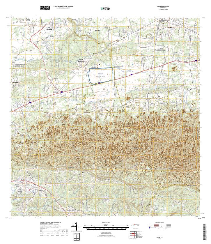
Loading map...1964 Map of Moca
USGS Topo · Published 1967About this map
Moca sits at the southwestern edge of this landscape, where the urban settlement gives way to the ridges of the Cordillera Jaicoa. The map reveals a transition between the northern coastal plains and the interior highlands, marked by significant infrastructure including the Antigua Via del Ferrocarril and multiple power stations such as Central Hidroelectrica No 3. These facilities, alongside the Canal Principal, reflect a mid-century focus on hydraulic and electrical development in the region.
Find a feature on this map
74 named features on this map. Tap any name to fly to it.
Don’t see what you’re looking for? This feature index may not catch every label — zoom into the map to look around manually.
Map Details
Date Portrayed1964
Date Published1967
PublisherU.S. Geological Survey
Map TypeTopographic
Scale1:20,000
Physical Dimensions29.3 x 32 inches
Editions of this 1964 Moca Map
3 editions found
Historical Maps of Moca Through Time
8 maps found


Featured Locations
- Reparto Méndez, Isabela
- Sector Los Laureles, Aguadilla
- Reparto Santa María, Aguadilla
- Sector Nieves, Moca
- Moca, Moca
Source Details
SourceU.S. Geological Survey
CopyrightPublic Domain