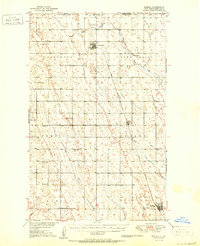
1950 Map of Mohall
USGS Topo · Published 1950About this map
The international border between the Canada United States and Saskatchewan North Dakota defines the northern reaches of this mid-century Renville County landscape. The rail-oriented economy is anchored by the Great Northern railroad, which connects the significant settlements of Mohall, Loraine, and Sherwood. Near the border, the U. S. Port of Entry and a Landing Field highlight the area's role in cross-border transit and early regional aviation.
Find a feature on this map
26 named features on this map. Tap any name to fly to it.
Don’t see what you’re looking for? This feature index may not catch every label — zoom into the map to look around manually.
Map Details
Editions of this 1950 Mohall Map
2 editions found

Other maps of this area

1947 · Tolley
USGS Topo · 1:62,500

1948 · Dokken SW
USGS Topo · 1:24,000

1948 · Mohall
USGS Topo · 1:24,000

1948 · Tolley
USGS Topo · 1:24,000

1948 · Lansford
USGS Topo · 1:62,500

1949 · Lansford NW
USGS Topo · 1:24,000

1949 · Mohall SW
USGS Topo · 1:24,000

1949 · Mohall NE
USGS Topo · 1:24,000

1949 · Sherwood
USGS Topo · 1:24,000

1949 · Greene
USGS Topo · 1:24,000