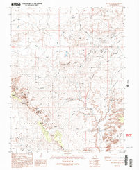
1991 Map of Mollie Hogans
USGS Topo · Published 1991About this map
Arches National Park defines the southwestern portion of this landscape, showcasing a remarkable concentration of geological landmarks including Landscape Arch, Double O Arch, and Skyline Arch. The terrain transitions from the high desert relief of The Highlands and Winter Camp Ridge down into the expansive Salt Valley. Outside the park boundaries, the map reveals a heavy industrial presence centered around Yellow Cat Flat and Yellow Cat Mesa. This area is densely marked with uranium-era mining features such as the Telluride Mines, Ringtail Mine, and the Blackstone Incline. The network of Yellow Cat Road and numerous unnamed 4WD tracks connects these remote sites, providing a clear view of the mid-to-late 20th-century extraction landscape. For those interested in the human imprint on this desert, the Devils Garden Campground and various prospects scattered across The Poison Strip offer a record of both recreation and resource discovery.
Find a feature on this map
53 named features on this map. Tap any name to fly to it.
Don’t see what you’re looking for? This feature index may not catch every label — zoom into the map to look around manually.
Map Details
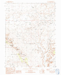
Editions of this 1991 Mollie Hogans Map
2 editions found
Other maps of this area

1885 · La Sal
USGS Topo · 1:250,000

1952 · Moab 4 NW
USGS Topo · 1:24,000

1954 · Mt. Waas 3 NW
USGS Topo · 1:24,000

1954 · Castle Valley
USGS Topo · 1:62,500

1956 · Moab
USGS Topo · 1:250,000

1958 · Thompson
USGS Topo · 1:62,500

1958 · Cisco
USGS Topo · 1:62,500

1959 · Moab
USGS Topo · 1:250,000
1959 · Moab
USGS Topo · 1:62,500
1959 · Moab 4 NE
USGS Topo · 1:24,000