
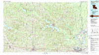
1985 Map of Monroe North
USGS Topo · Published 1986About this map
Lake D'Arbonne and the sprawling Bayou D'Arbonne waterway system dominate this mid-1980s landscape of north-central Louisiana, where timber, education, and energy extraction intersect. The map documents the extensive Monroe Gas Field and Calhoun Gas and Oil Field, which underscore the industrial character of the region. Educational hubs are prominently featured, including the campuses of Louisiana Tech University in Ruston and Grambling State University in Grambling.
Find a feature on this map
116 named features on this map. Tap any name to fly to it.
Don’t see what you’re looking for? This feature index may not catch every label — zoom into the map to look around manually.
Map Details
Editions of this 1985 Monroe North Map
2 editions found
Other maps of this area

1927 · El Dorado
USGS Topo · 1:62,500

1930 · El Dorado
USGS Topo · 1:62,500

1933 · Strong
USGS Topo · 1:62,500

1934 · Felsenthal
USGS Topo · 1:62,500

1935 · Collinston
USGS Topo · 1:62,500

1935 · Naff
USGS Topo · 1:62,500

1935 · Alto
USGS Topo · 1:62,500

1935 · Drew
USGS Topo · 1:62,500

1935 · Haile
USGS Topo · 1:62,500

1937 · Strong
USGS Topo · 1:62,500