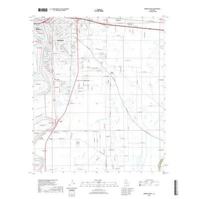
2018 Map of Monroe South
USGS Topo · Published 2018About this map
The Ouachita River serves as the central artery for this region of northern Louisiana, dividing the urban centers of Monroe and West Monroe. A protective levee follows the river's western bank, while the eastern side is defined by a dense network of suburban development and smaller settlements like Richwood and Rilla. The landscape is heavily influenced by a series of bayous, including Youngs Bayou, Petticoat Bayou, and Gourd Bayou, which thread through the flat terrain south of the city. Genealogists and local historians can locate several burial grounds, such as Riverview Cem near the riverfront and Ballard Cem further east. The map also documents educational and commercial hubs, including the Louisiana Delta Community College Main Campus in Magenta and the community of Maidco near the southern bend of the river.
Find a feature on this map
119 named features on this map. Tap any name to fly to it.
Don’t see what you’re looking for? This feature index may not catch every label — zoom into the map to look around manually.
Map Details
Editions of this 2018 Monroe South Map
This is the sole edition of this map. No revisions or reprints were ever made.
Other maps of this area

1935 · Collinston
USGS Topo · 1:62,500

1935 · Alto
USGS Topo · 1:62,500

1935 · Drew
USGS Topo · 1:62,500

1940 · Monroe
USGS Topo · 1:62,500

1955 · Jackson
USGS Topo · 1:250,000

1955 · Shreveport
USGS Topo · 1:250,000

1956 · Shreveport
USGS Topo · 1:250,000

1957 · Monroe North
USGS Topo · 1:62,500

1957 · West Monroe North
USGS Topo · 1:24,000

1957 · Mangham
USGS Topo · 1:62,500