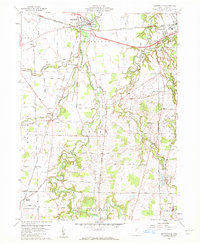
1960 Map of Monroeville
USGS Topo · Published 1961About this map
Monroeville sits at a major crossroads of mid-century infrastructure where the Baltimore and Ohio and the New York Central and St Louis railroads intersect. This 1960 survey captures the rural landscape of central Huron County just as its mid-century transport network was firmly established. The hydrology of the region is defined by the winding course of the Huron River and its multiple tributaries, including the West Branch Huron River and East Branch Huron River, which carve through the townships of Ridgefield and Peru.
Find a feature on this map
51 named features on this map. Tap any name to fly to it.
Don’t see what you’re looking for? This feature index may not catch every label — zoom into the map to look around manually.
Map Details
Editions of this 1960 Monroeville Map
2 editions found
Other maps of this area

1901 · Bellevue
USGS Topo · 1:62,500

1903 · Bellevue
USGS Topo · 1:62,500

1904 · Sandusky
USGS Topo · 1:62,500

1915 · Norwalk
USGS Topo · 1:62,500

1915 · Siam
USGS Topo · 1:62,500

1944 · Norwalk
USGS Topo · 1:62,500

1956 · Toledo
USGS Topo · 1:250,000

1959 · Kimball
USGS Topo · 1:24,000

1959 · Milan
USGS Topo · 1:24,000
1959 · Bellevue
USGS Topo · 1:24,000