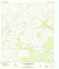
1963 Map of Monteola
USGS Topo · Published 1978About this map
Medio Creek and its tributaries, Sulphur Creek and Dry Medio Creek, wind through this section of the Texas coastal plain during the early 1960s. The landscape reflects a mix of ranching and early petroleum development, most notably within the Caesar Oil Field where several Oil Wells dot the terrain. Small rural settlements like Caesar and Monteola serve as local hubs for the surrounding countryside, while larger family-named sites such as Zunkerville and Bainville indicate the area's pioneer roots. Genealogists will find particular value in the location of the Pullin Livingston Cem and Elim Ch, which provided spiritual and social focal points for this rural community spanning the boundary of Karnes Co Bee Co. Numerous Gravel Pits and a sprawling network of Pipelines further reveal the mid-century industrial activity that shaped this region.
Find a feature on this map
15 named features on this map. Tap any name to fly to it.
Don’t see what you’re looking for? This feature index may not catch every label — zoom into the map to look around manually.
Map Details
Editions of this 1963 Monteola Map
3 editions found
Other maps of this area

1931 · Falls City
USGS Topo · 1:62,500

1936 · Pettus
USGS Topo · 1:62,500

1953 · Crystal City
USGS Topo · 1:250,000

1953 · Beeville
USGS Topo · 1:250,000

1955 · Crystal City
USGS Topo · 1:250,000

1956 · Suniland
USGS Topo · 1:62,500

1956 · Beeville
USGS Topo · 1:250,000

1956 · Pettus
USGS Topo · 1:62,500

1956 · Karnes City
USGS Topo · 1:62,500

1960 · Beeville
USGS Topo · 1:250,000