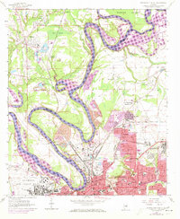
1958 Map of Montgomery North
USGS Topo · Published 1973About this map
The Alabama River and Tallapoosa River converge at the northern edge of this map, creating a complex hydrologic landscape defined by deep meanders and cutoffs like Dead Lake. The 1972 photorevision highlights the northward expansion of Montgomery, showing urban growth creeping toward Boylston and Chisholm. Significant civil and military infrastructure anchors the area, from the State Capitol and City Hall downtown to the sprawling grounds of Maxwell Air Force Base and Gunter Air Force Base.
Find a feature on this map
61 named features on this map. Tap any name to fly to it.
Don’t see what you’re looking for? This feature index may not catch every label — zoom into the map to look around manually.
Map Details
Editions of this 1958 Montgomery North Map
4 editions found
Other maps of this area

1901 · Wetumpka
USGS Topo · 1:125,000

1901 · Wetumpka
USGS Topo · 1:62,500

1903 · Wetumpka
USGS Topo · 1:125,000

1927 · Montgomery
USGS Topo · 1:48,000

1930 · Montgomery
USGS Topo · 1:62,500

1953 · Montgomery
USGS Topo · 1:250,000

1956 · Montgomery
USGS Topo · 1:250,000

1957 · Montgomery
USGS Topo · 1:250,000

1958 · Montgomery
USGS Topo · 1:62,500

1958 · Montgomery North
USGS Topo · 1:24,000