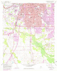
1958 Map of Montgomery South
USGS Topo · Published 1982About this map
Maxwell Air Force Base and its adjacent Maxwell Storage Annex dominate the northwestern landscape of this Alabama capital city, marking the area's mid-century military importance. The urban grid of Montgomery is exceptionally dense with educational and social institutions, ranging from Alabama State College and Huntingdon College to specialized sites like the Masonic Home and the St Jude Institution. Transportation networks such as the Western Railway of Alabama and Louisville and Nashville Railroad define the industrial corridors, while the southern reaches of the map transition into the swampy bottomlands of Catoma Creek. These low-lying areas, punctuated by Whites Slough and Baldwin Slough, reveal a distinct contrast between the organized city blocks and the meandering natural drainage patterns that limited early suburban expansion to the south.
Find a feature on this map
63 named features on this map. Tap any name to fly to it.
Don’t see what you’re looking for? This feature index may not catch every label — zoom into the map to look around manually.
Map Details
Editions of this 1958 Montgomery South Map
5 editions found
Other maps of this area

1927 · Montgomery
USGS Topo · 1:48,000

1930 · Montgomery
USGS Topo · 1:62,500

1953 · Montgomery
USGS Topo · 1:250,000

1956 · Montgomery
USGS Topo · 1:250,000

1957 · Montgomery
USGS Topo · 1:250,000

1957 · Letohatchee
USGS Topo · 1:62,500

1958 · Montgomery
USGS Topo · 1:62,500

1958 · Montgomery North
USGS Topo · 1:24,000

1958 · Montgomery South
USGS Topo · 1:24,000

1958 · Mount Meigs
USGS Topo · 1:62,500
Featured Places
- Montgomery, AL
- Perry Hills, Montgomery
- Cleveland Meadows, Montgomery
- Windwood, Montgomery
- Mayfair, Montgomery