
1962 Map of Monticello North
USGS Topo · Published 1964About this map
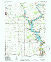
Lake Shafer dominates the eastern portion of this 1962 landscape, where the Tippecanoe River is harnessed at the Norway Dam. This region of White County showcases a transition from the agricultural plains defined by complex drainage networks like Monon Ditch and Hoagland Ditch to the burgeoning recreational and residential developments along the river. The small settlement of Norway sits just above Monticello, while further north, the Isle of Homes represents the era's lakeside growth. Transportation and industry are anchored by the Monon RR and the Pennsylvania RR, which intersect the agricultural grid near Monon and Reynolds. Local community life is preserved through numerous rural landmarks, including the Monon Chapel, Twp Sch, and the Lakeview County Home, providing a detailed look at the county's social infrastructure during the early 1960s.
Find a feature on this map
54 named features on this map. Tap any name to fly to it.
Don’t see what you’re looking for? This feature index may not catch every label — zoom into the map to look around manually.
Map Details
Editions of this 1962 Monticello North Map
2 editions found
Other maps of this area

1953 · Danville
USGS Topo · 1:250,000

1955 · Danville
USGS Topo · 1:250,000

1956 · Danville
USGS Topo · 1:250,000

1962 · Buffalo
USGS Topo · 1:24,000

1962 · Monticello South
USGS Topo · 1:24,000

1962 · Monon NE
USGS Topo · 1:24,000

1962 · Brookston NW
USGS Topo · 1:24,000

1962 · Monon
USGS Topo · 1:24,000
1962 · Francesville
USGS Topo · 1:24,000
1962 · Yeoman
USGS Topo · 1:24,000