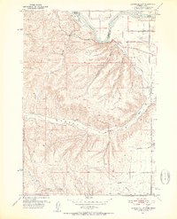
1951 Map of Moores Hollow
USGS Topo · Published 1952About this map
The Snake River defines the northeastern boundary of this 1950s landscape, weaving past Westlake Island and McRea Island as it marks the border between Idaho and Oregon. The terrain is defined by a series of prominent drainage systems including Bridge Gulch, Wickup Gulch, and Jacobsen Gulch, which cut through the high ground above Weiser Flat. This era shows a growing agricultural infrastructure reliant on water management, evidenced by the Owyhee Canal and several scattered Windmills used to sustain life in the drier reaches of the hollows.
Find a feature on this map
27 named features on this map. Tap any name to fly to it.
Don’t see what you’re looking for? This feature index may not catch every label — zoom into the map to look around manually.
Map Details
Editions of this 1951 Moores Hollow Map
4 editions found
Other maps of this area

1897 · Weiser
USGS Topo · 1:125,000

1951 · Moores Hollow
USGS Topo · 1:24,000

1951 · Malheur Butte
USGS Topo · 1:24,000

1951 · Moores Hollow
USGS Topo · 1:62,500

1951 · Payette
USGS Topo · 1:24,000

1951 · Weiser South
USGS Topo · 1:24,000

1952 · Olds Ferry
USGS Topo · 1:24,000

1952 · Olds Ferry
USGS Topo · 1:62,500

1952 · Olds Ferry SE
USGS Topo · 1:24,000

1953 · Mann Creek
USGS Topo · 1:62,500