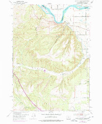
1951 Map of Moores Hollow
USGS Topo · Published 1978About this map
The Snake River defines the northern boundary of this high-desert landscape on the border of Oregon and Idaho, where the river's path is punctuated by Westlake Island and McRea Island. A Ferry crossing near the county line indicates the importance of river transit before modern bridging, while the Owyhee Canal and Upper Ditch signify the vital role of irrigation in transforming the arid West Weiser Flat for agricultural use.
Find a feature on this map
32 named features on this map. Tap any name to fly to it.
Don’t see what you’re looking for? This feature index may not catch every label — zoom into the map to look around manually.
Map Details
Editions of this 1951 Moores Hollow Map
4 editions found
Other maps of this area

1897 · Weiser
USGS Topo · 1:125,000

1951 · Moores Hollow
USGS Topo · 1:24,000

1951 · Malheur Butte
USGS Topo · 1:24,000

1951 · Moores Hollow
USGS Topo · 1:62,500

1951 · Payette
USGS Topo · 1:24,000

1951 · Weiser South
USGS Topo · 1:24,000

1952 · Olds Ferry
USGS Topo · 1:24,000

1952 · Olds Ferry
USGS Topo · 1:62,500

1952 · Olds Ferry SE
USGS Topo · 1:24,000

1953 · Mann Creek
USGS Topo · 1:62,500