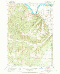
1951 Map of Moores Hollow
USGS Topo · Published 1966About this map
The Snake River serves as the prominent boundary between Oregon and Idaho in this 1951 survey, winding past Westlake Island and McRea Island. The landscape is defined by the sharp transition from the irrigated plains of West Weiser Flat to the dissected uplands of Moores Hollow. Water management is central to the area's development, evidenced by the Owyhee Canal and the Upper Ditch tracing the contours of the eastern slopes, while isolated Windmills and springs like Wickup Springs and King Spr suggest a reliance on scattered water sources for livestock and remote homesteads. The terrain is deeply etched with numerous drainage features, including Wickup Gulch, Patch Gulch, and Bridge Gulch, highlighting the complex topography that early settlers and ranchers navigated in Malheur County.
Find a feature on this map
26 named features on this map. Tap any name to fly to it.
Don’t see what you’re looking for? This feature index may not catch every label — zoom into the map to look around manually.
Map Details
Editions of this 1951 Moores Hollow Map
4 editions found
Other maps of this area

1897 · Weiser
USGS Topo · 1:125,000

1951 · Moores Hollow
USGS Topo · 1:24,000

1951 · Malheur Butte
USGS Topo · 1:24,000

1951 · Moores Hollow
USGS Topo · 1:62,500

1951 · Payette
USGS Topo · 1:24,000

1951 · Weiser South
USGS Topo · 1:24,000

1952 · Olds Ferry
USGS Topo · 1:24,000

1952 · Olds Ferry
USGS Topo · 1:62,500

1952 · Olds Ferry SE
USGS Topo · 1:24,000

1953 · Mann Creek
USGS Topo · 1:62,500