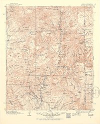
1913 Map of Morenci
USGS Topo · Published 1954About this map
Apache National Forest dominates this high-altitude landscape along the border of Arizona and New Mexico, where the remote canyons of the Blue River meet the early industrial activity of the copper region. Settled outposts such as Granville and Boyles appear alongside numerous family ranches, including the Slaughter Ranch and Double Circle Ranch, reflecting a ranching economy that thrived before modern infrastructure reached these canyons.
Find a feature on this map
189 named features on this map. Tap any name to fly to it.
Don’t see what you’re looking for? This feature index may not catch every label — zoom into the map to look around manually.
Map Details
Editions of this 1913 Morenci Map
2 editions found
Other maps of this area

1902 · Clifton
USGS Topo · 1:62,500

1910 · Mogollon
USGS Topo · 1:125,000

1912 · Mogollon
USGS Topo · 1:125,000

1913 · Morenci
USGS Topo · 1:125,000

1915 · Morenci
USGS Topo · 1:125,000

1915 · Reserve
USGS Topo · 1:125,000

1918 · Reserve
USGS Topo · 1:125,000

1922 · Nutrioso
USGS Topo · 1:125,000

1954 · Silver City
USGS Topo · 1:250,000

1954 · Clifton
USGS Topo · 1:250,000