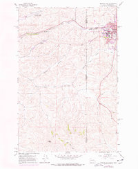
1964 Map of Moscow West
USGS Topo · Published 1978About this map
The University of Idaho campus and the western fringes of Moscow dominate the eastern edge of this mid-century landscape, where the Palouse hills meet the Washington-Idaho state line. This 1970s photorevised edition reveals a transition from the academic and urban core out toward the Pullman-Moscow Regional Airport and the small settlement of Sunshine. The terrain is defined by the winding courses of the South Fork Palouse River and Paradise Creek, which dictated the routes of the Burlington Northern and Pacific Union railroads. Local landmarks like the Drive-in Theater and numerous Gravel Pits suggest the mid-century industrial and social character of the area. To the south, the elevation rises toward Bald Butte, overlooking the agricultural drainage of Stratton Hollow and Little Thorn Creek.
Find a feature on this map
26 named features on this map. Tap any name to fly to it.
Don’t see what you’re looking for? This feature index may not catch every label — zoom into the map to look around manually.
Map Details
Editions of this 1964 Moscow West Map
3 editions found
Other maps of this area

1910 · Pullman
USGS Topo · 1:125,000

1955 · Pullman
USGS Topo · 1:250,000

1958 · Pullman
USGS Topo · 1:250,000

1960 · Robinson Lake
USGS Topo · 1:24,000

1960 · Moscow East
USGS Topo · 1:24,000

1960 · Potlatch
USGS Topo · 1:62,500

1961 · Moscow
USGS Topo · 1:62,500

1964 · Viola
USGS Topo · 1:24,000

1964 · Moscow West
USGS Topo · 1:24,000

1964 · Colton
USGS Topo · 1:24,000