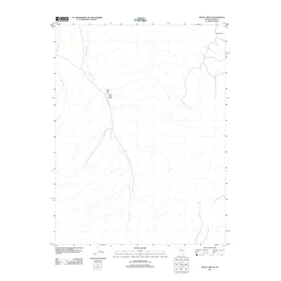
2011 Map of Mount Airy NE
USGS Topo · Published 2011About this map
Antelope Creek and Gilbert Creek drain this arid portion of Lander County, highlighting the drainage patterns of the Great Basin landscape. The map shows the north-eastern portion of the Mount Airy region, dominated by high-desert terrain including White Sage Flat and the adjacent White Sage Canyon. Human settlement is sparse, concentrated near the historic site of Ravenswood in the northeast corner of the quadrangle. Localized water sources, such as Cadro Spring, provide critical points of reference in an area otherwise defined by seasonal washes and varying elevations. The layout of early 21st-century unpaved roads and trails follows the natural contours of the desert, illustrating how topography dictates movement and land use in this remote Nevada corridor.
Find a feature on this map
6 named features on this map. Tap any name to fly to it.
Don’t see what you’re looking for? This feature index may not catch every label — zoom into the map to look around manually.
Map Details
Editions of this 2011 Mount Airy NE Map
This is the sole edition of this map. No revisions or reprints were ever made.
Other maps of this area

1955 · Millett
USGS Topo · 1:250,000

1959 · Millett
USGS Topo · 1:250,000

1969 · Manhattan Mtn
USGS Topo · 1:24,000

1969 · Gilbert Creek SE
USGS Topo · 1:24,000

1969 · Mount Airy
USGS Topo · 1:24,000

1969 · Vigus Butte
USGS Topo · 1:24,000

1969 · Gilbert Creek SW
USGS Topo · 1:24,000

1969 · Vigus Butte NW
USGS Topo · 1:24,000

1969 · Mount Airy NW
USGS Topo · 1:24,000

1969 · Mount Airy NE
USGS Topo · 1:24,000