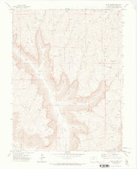
1971 Map of Mount Blaine
USGS Topo · Published 1973About this map
Mount Blaine anchors this high-elevation terrain in Garfield County, defining a landscape dominated by steep drainages and prominent divides in the early 1970s. The survey reveals a region defined by its hydrography and resource extraction, with numerous unnamed Prospects and a Gravel Pit scattered among the gulches. Water management is evident in the Gibler Ditch, which follows the contours above Clear Creek.
Find a feature on this map
27 named features on this map. Tap any name to fly to it.
Don’t see what you’re looking for? This feature index may not catch every label — zoom into the map to look around manually.
Map Details
Editions of this 1971 Mount Blaine Map
3 editions found
Other maps of this area

1925 · Parachute Creek
USGS Topo · 1:62,500

1927 · Parachute Creek
USGS Topo · 1:62,500

1929 · Grand Valley
USGS Topo · 1:62,500

1929 · Highmore
USGS Topo · 1:62,500

1929 · Roan Creek
USGS Topo · 1:62,500

1956 · Grand Junction
USGS Topo · 1:250,000

1959 · Grand Junction
USGS Topo · 1:250,000

1960 · Grand Junction
USGS Topo · 1:250,000

1962 · Grand Junction
USGS Topo · 1:250,000
1962 · Red Pinnacle
USGS Topo · 1:24,000