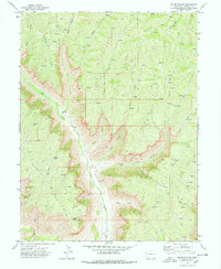
1971 Map of Mount Blaine
USGS Topo · Published 1978About this map
Mount Blaine rises as a prominent landmark in this 1970s topographic study of Garfield County, marking a landscape defined by sharp ridges and deep drainage systems. The map captures the industrial and hydrological footprint of the era, notably the scattered Prospects and a Drill Hole that indicate mineral exploration across Skinner Ridge and Puddin Ridge. Water management is evident through the Gibler Ditch, which follows the contours near the southern boundary, while Deer Park provides a notable natural basin amidst the surrounding gulches. The terrain is crisscrossed by a network of Pack Trails and Jeep Trails, suggesting a region primarily accessed for resource extraction and land management rather than dense settlement. Large-scale features like Clear Creek and Buck Gulch dictate the movement of travelers through this high-elevation Colorado territory.
Find a feature on this map
31 named features on this map. Tap any name to fly to it.
Don’t see what you’re looking for? This feature index may not catch every label — zoom into the map to look around manually.
Map Details
Editions of this 1971 Mount Blaine Map
3 editions found
Other maps of this area

1925 · Parachute Creek
USGS Topo · 1:62,500

1927 · Parachute Creek
USGS Topo · 1:62,500

1929 · Grand Valley
USGS Topo · 1:62,500

1929 · Highmore
USGS Topo · 1:62,500

1929 · Roan Creek
USGS Topo · 1:62,500

1956 · Grand Junction
USGS Topo · 1:250,000

1959 · Grand Junction
USGS Topo · 1:250,000

1960 · Grand Junction
USGS Topo · 1:250,000

1962 · Grand Junction
USGS Topo · 1:250,000
1962 · Red Pinnacle
USGS Topo · 1:24,000