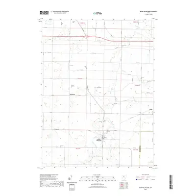
2019 Map of Mount Blanchard
USGS Topo · Published 2019About this map
The Blanchard River defines the drainage of this Hancock County landscape, winding northward past the village of Mount Blanchard. This 2019 survey captures the rural character of southeastern Hancock County at the border of Wyandot County, where small agricultural settlements like Houcktown and Pratts are connected by a grid of township and county roads. For genealogists and local historians, the map is particularly rich in cemetery locations, including the evocative Frontiers Repose Cem and others such as Elm Grove Cem and Krout Cem. The presence of Lutz Airport and a network of named waterways like Potato Run and Silver Cr provides a clear view of the area's modern infrastructure and natural hydrology, illustrating how development has centered on the river valley and its various tributaries.
Find a feature on this map
88 named features on this map. Tap any name to fly to it.
Don’t see what you’re looking for? This feature index may not catch every label — zoom into the map to look around manually.
Map Details
Editions of this 2019 Mount Blanchard Map
This is the sole edition of this map. No revisions or reprints were ever made.
Other maps of this area

1901 · Fostoria
USGS Topo · 1:62,500

1903 · Fostoria
USGS Topo · 1:62,500

1903 · Findlay
USGS Topo · 1:62,500

1905 · Arlington
USGS Topo · 1:62,500

1907 · Arlington
USGS Topo · 1:24,000

1907 · Upper Sandusky
USGS Topo · 1:62,500

1950 · Marion
USGS Topo · 1:250,000

1956 · Toledo
USGS Topo · 1:250,000

1960 · Alvada
USGS Topo · 1:24,000

1960 · Arlington
USGS Topo · 1:24,000