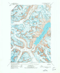
1961 Map of Mount Fairweather D-4
USGS Topo · Published 1977About this map
Glacier Bay National Monument dominates this mid-century topographic study, capturing a frozen landscape of moving ice and deep fjords. The massive Margerie Glacier and Johns Hopkins Glacier are shown flowing into Johns Hopkins Inlet, documented here before decades of glacial retreat would significantly alter their terminus positions. These immense ice bodies are flanked by the high peaks of the Fairweather Range, including Mt Turner on the international boundary between British Columbia and Alaska.
Find a feature on this map
20 named features on this map. Tap any name to fly to it.
Don’t see what you’re looking for? This feature index may not catch every label — zoom into the map to look around manually.
Map Details
Editions of this 1961 Mount Fairweather D-4 Map
2 editions found
Other maps of this area

1951 · Mt Fairweather
USGS Topo · 1:250,000

1952 · Skagway
USGS Topo · 1:250,000

1961 · Skagway A-7
USGS Topo · 1:63,360

1961 · Mount Fairweather D-4
USGS Topo · 1:63,360
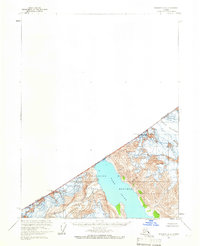
1961 · Skagway A-6
USGS Topo · 1:63,360

1961 · Mount Fairweather D-5
USGS Topo · 1:63,360

1961 · Mount Fairweather C-4
USGS Topo · 1:63,360

1961 · Mount Fairweather C-3
USGS Topo · 1:63,360

1961 · Mount Fairweather C-5
USGS Topo · 1:63,360

1961 · Mount Fairweather D-3
USGS Topo · 1:63,360